首页/产品/Universal Maps Downloader

Universal Maps Downloader

v10.263 发布于 Nov 15, 2026 Windows 7 / 8 / 10 / 11

将在线地图的瓦片图像保存到自己的电脑,作为真正的离线地图保留——无需订阅,也不会上传任何内容到任何地方。

Universal Maps Downloader
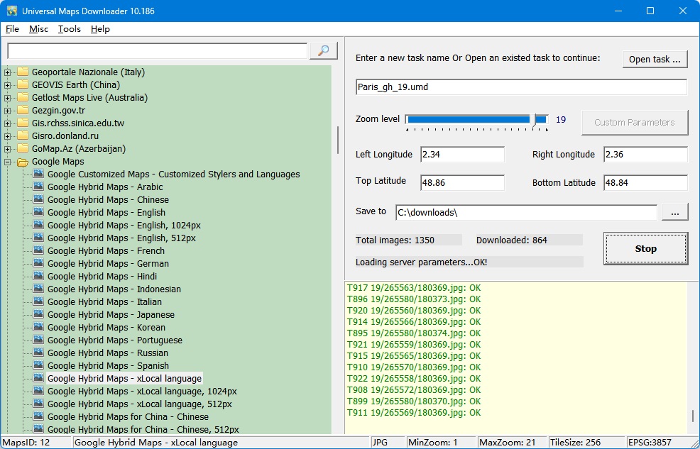
Universal Maps Downloader 截图

所有下载的小图片都保存在磁盘上。您可以通过 Maps Viewer 查看下载的地图,也可以使用 Maps Combiner 将它们拼接成 BMP/TIFF/JPG/PNG/SIG/IMG/KMZ/RST/PNM/PDF/MBtiles/GPKG/WEBP/SQLITE/MRF/HDF/netCDF 文件,还可以将所有瓦片导出为 MBTiles 格式的数据库。

它非常易于使用。 点击这里查看使用方法。

请 点击此处查看所有地图类型(5000+ 种),以及 点击此处查看所有瓦片示例。

可下载的地图来源

Universal Maps Downloader 是一款帮助您从在线地图获取小块瓦片图像的工具:

!Custom Map Type, Alpenkarte.eu, Amudanan.co.il (Israel), Apple Maps, Arcanum Maps, Arcgis Online, Arkansas GIS Offlice Map (USA), Atlas.harita.gov.tr (Turkey), Austrian Map, Baidu Map (China), Balad.ir, Basemap.at Karte (Austria), Basemap.de, BBBike Map Compare, Bergfex.at, BGMountains Online Maps (Bulgaria), Bhumi.atrbpn.go.id (Indonesia), Bhuvan-2D (India), Bing Maps, Box Locator Map, CalTopo, Camapka.ru, Carte-Geoportail, CARTO Basemaps, City of Cape Town (South Africa), CoCoRaHS Maps, Connecticut Environmental Conditions Online (USA), Cyberjapandata.gsi.go.jp, Cycle.travel, Cyclosm.org, Data.shom.fr, David Rumsey Historical Map Collection, Discover GIS Data NY (NewYork, USA), Ditu.so.com (China), Dituhui.com (China), Earth.jl1.cn, Eniro(kartor.eniro.se), EOX Maps, Esri Netherlands Content, FINN Kart, Freemap Slovakia, FY-3D Global Image, GAIA GPS Maps, Gaode Map (www.amap.com China), GeaMap.com, Geo.be Map, Geobru.irisnet.be (Belgium), Geofabrik OSM Inspector, Geogratis.gc.ca, Geokatalog.buergernetz.bz.it (Italy), Geoportail.wallonie.be, GeoPortal CGIS Qatar, Geoportal PH (Philippines), Geoportal Sachsenatlas (Germany), Geoportal.ancpi.ro (Romania), GeoPortal.MV, GEOportal.NRW, Geoportale Nazionale (Italy), Geoscience Australia, Geoviewer.sachsen.de, GEOVIS Earth (China), Getlost Maps Live (Australia), Gezgin.gov.tr, Gis.rchss.sinica.edu.tw, Gis3.nve.no, Gisro.donland.ru, GoMap.Az (Azerbaijan), Google Maps, GovMap Israel Maps, Gps.tile.openstreetmap.org, GraphHopper Maps, Here Maps, HGSS Cartography (Croatia), HiFleet, Hillshade - OpenStreetMap US Tileservice, ICGC Vissir3 (Catalunya, Spain), Icgc.cat, Ideihm.covam.es, Ign.es (Spain), Ign.gob.ar, Imagico.de maps, Isprambiente.it, Israel hiking map, Jawg Maps, Kakaomap - Daum Map (South Korea), Kanton Aargau (Switzerland), Kanton Solothurn (Switzerland), Kanton Zug (Switzerland), Kanton Zurich (Switzerland), Kartat.kapsi.fi (Finland), Kartbild.com, Karten von Attika, Kartogiraffe.de, Kartverket.no (Norway), Kompass.de, Kort-krak.dk, Kort.lmi.is (Iceland), Kortoverblik.dk, LA County (Los Angeles, USA), Lantmateriets Fjallkarta (Swedish), Light pollution map, Location SA Map Viewer (South Australia), Longdo Map (Thailand), Lvmgeoserver.lvm.lv (Latvia), MAA-AMET (Estonia), Make A Topographic Map (Canada), Map of cities of UAE - 2GIS, Map of Serbia, Map Warper - mapwarper.onki.fi, Map Warper - mapwarper.prov.vic.gov.au, Map Warper - warper.wmflabs.org, Map Warper - www.mapwarper.net, Map.geoportail.lu, Map.geoq.cn (China), Map.meta.ua, Map.turistautak.hu, Map.valentim.org (Portugal), MapAnt (Finland), Mapas.bogota.gov.co (Colombia), Mapbox, MapFan (Japan), maphub.cn, Mapion (Japan), Mappls (India), Mappy.com, MapQuest Map, Maps of Switzerland, Maps-for-free.com, Maps.eatlas.org.au (Australia), Maps.lt (Lithuania), Maps.nlsc.gov.tw, Maps.rlp.de, Maps.stamen.com, MapSite (NLS of Finland), Maptoolkit, Mapy.cz, Mapzs.pzs.si (Slovenia), Mesa County GIS Viewer (CO, USA), Mierune map (Japan), Min Karta (Sweden), MinView (Australia), Moovit, MOSCOWMAP (Russia), MTBmap.cz, MTBmap.no, MyGeoMap (Malaysia), Nakarte.me, Napr Maps (Georgia), NASA GIBS, National Library of Scotland (maps.nls.uk), National Map (Australia), Naver Map (South Korea), Navitel.Maps, New HK Maps, New Zealand Gazetteer, New Zealand Topographic Maps, Ngi.be (Belgium), NL Maps (Netherlands), Norgeskart (Norway), North Carolina Maps (USA), Norwegian Polar Institute, Nostra Map (Thailand), NSW Historical Imagery (Australia), NSW SIX Maps (Australia), NZ Topo Map, Omniscale, Onemap (Singapore), Online Maps for China, Open Data DC (USA), OpenAerialMap, OpenCycleMap.org, OpenFireMap, Openmaps.fr, OpenRailwayMap, OpenSeaMap, OpenSnowMap, OpenStreetMap, OpenStreetMap Foundation Japan, OpenStreetMap.FR (France), Orda.of.by, OSGeo.cn (China), OSM deutscher Stil, Osm.rrze.fau.de, Osm.rrze.fau.de HD, Osmand.net, Parselsorgu.tkgm.gov.tr (Turkey), PDOK Viewer (Netherland), Petal Maps, PhilaGeoHistory Maps (Philadelphia, PA, USA), PhoneMaps, Polska.geoportal2.pl (Poland), portal.csdi.gov.hk, Portland Maps (Portland, USA), Publictransportmap.org, QA Tools (qa.poole.ch), Queensland Globe (Australia), Reit-und Wanderkarte (Hiking and Trail Riding Maps), Retromap.ru, Roscosmos Geoportal, S2maps.eu, SafeCast Map, SanGIS - (San Diego, USA), ScanEx Web Geomixer, Scgis.net, Scottish Index of Multiple Deprivation, Search.ch map, Sedecatastro.gob.es (Spain), Sentinel Explorer, Sentinel-2 map, SePlan (Norway), Services.geodataonline.no, ShipDT, Shipxy.com, SIWEIearth, Skoterleder.org, Snowmobile routes and ruts in Finland (Kelkkareitit.fi), Solargis.com, Stadia Maps, Strava Global Heatmap, Supermap (China), Susudata.de - messtisch, Sverige karta, Swisstopo, Tencent Map (China), Terinfo.ujbuda.hu (Hungary), Terkep.torokbalint.hu (Hungary), TerraScope, Thailand maps, The National Map (USA), Thueringen Viewer, Thunderforest, Tianditu (China), Tianditu Beijing (China), Tianditu Guangdong (China), Tianditu Shanghai (China), TileServer GL, Top-o-Viewer, Topomapviewer.ngi.be, Topotijdreis.nl, Topotresc, Toronto Maps (Canada), Tracestrack, TuristickaMapa.sk, Turku.fi, TuttoCitta (Italy), UMP-PC.pl, Ut.no Kart, ViaMichelin, Vietbando Maps (Vietnam), Visicom Maps (Ukraine), Visor.gva.es, Vlaanderen.be (Belgium), Wanderservice-schwarzwald.de, Waymarkedtrails.org, Waze Livemap, Web_PowerLine_KedUR, Whereis Maps of Australia, Wikimapia, Wikimedia Maps, World Imagery Wayback, Yahoo Japan Maps, Yahoo Maps, Yandex Maps (Russia), Custom Map Styles of Bing Maps, Customized Google Maps, 等

新版本有什么新功能? 点击此处 以查看更新历史。

实际演示

以下每张截图均取自程序本身——下载器、拼接器、查看器和导出工具。点击任意图片可打开全尺寸版本。

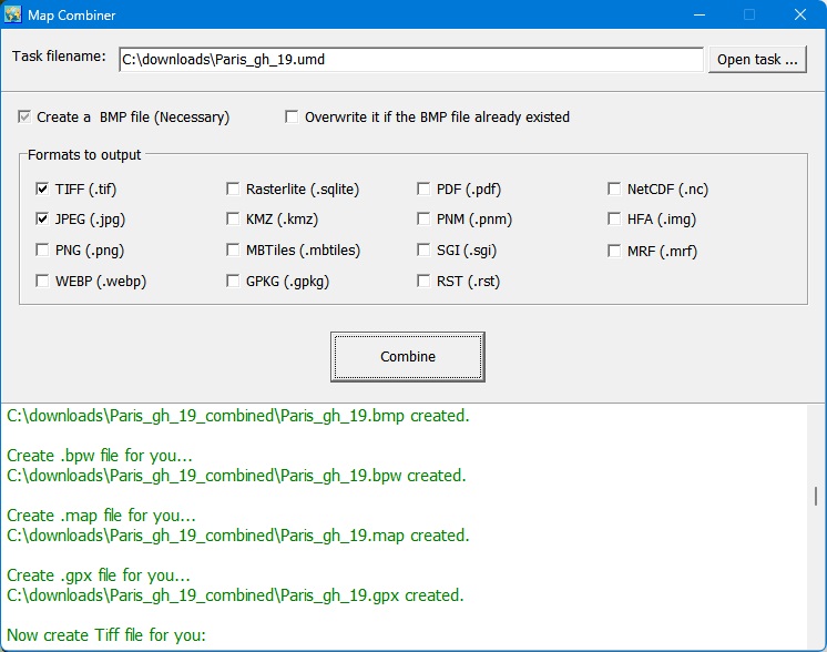
Map Combiner 截图

Map Combiner

将下载的瓦片拼接成一个大图像文件,支持任意导出格式。

查看原图
导出为 MBTiles 数据库

导出为 MBTiles 数据库

将全部下载内容放入 MBTiles 数据库,供其他 GIS 软件使用。

查看原图
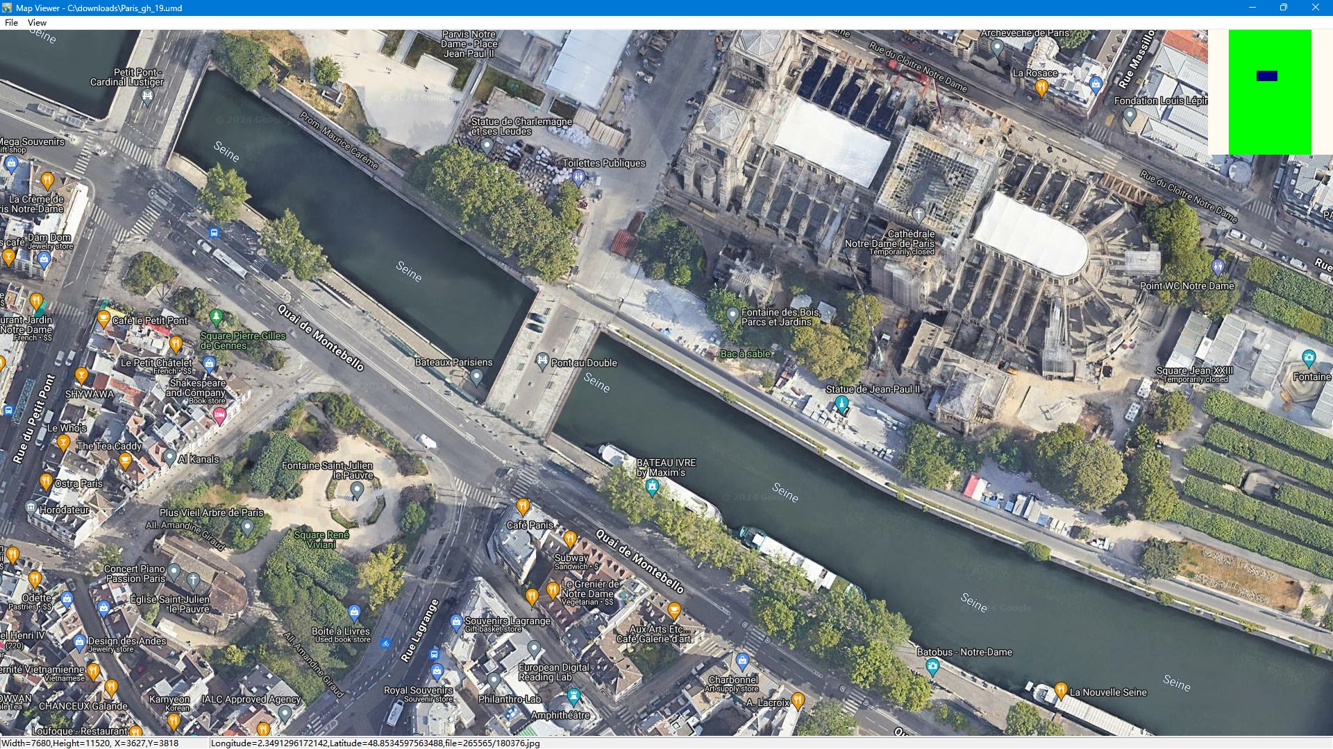
Map Viewer 截图

Map Viewer

离线浏览您下载的所有内容,并放大查看细节。

查看原图
作为 QGIS 中的图层

输出的 JPG 文件作为 QGIS 中的图层

可直接在 QGIS 中打开合并后的图像——它能与您的其他图层对齐。

查看原图
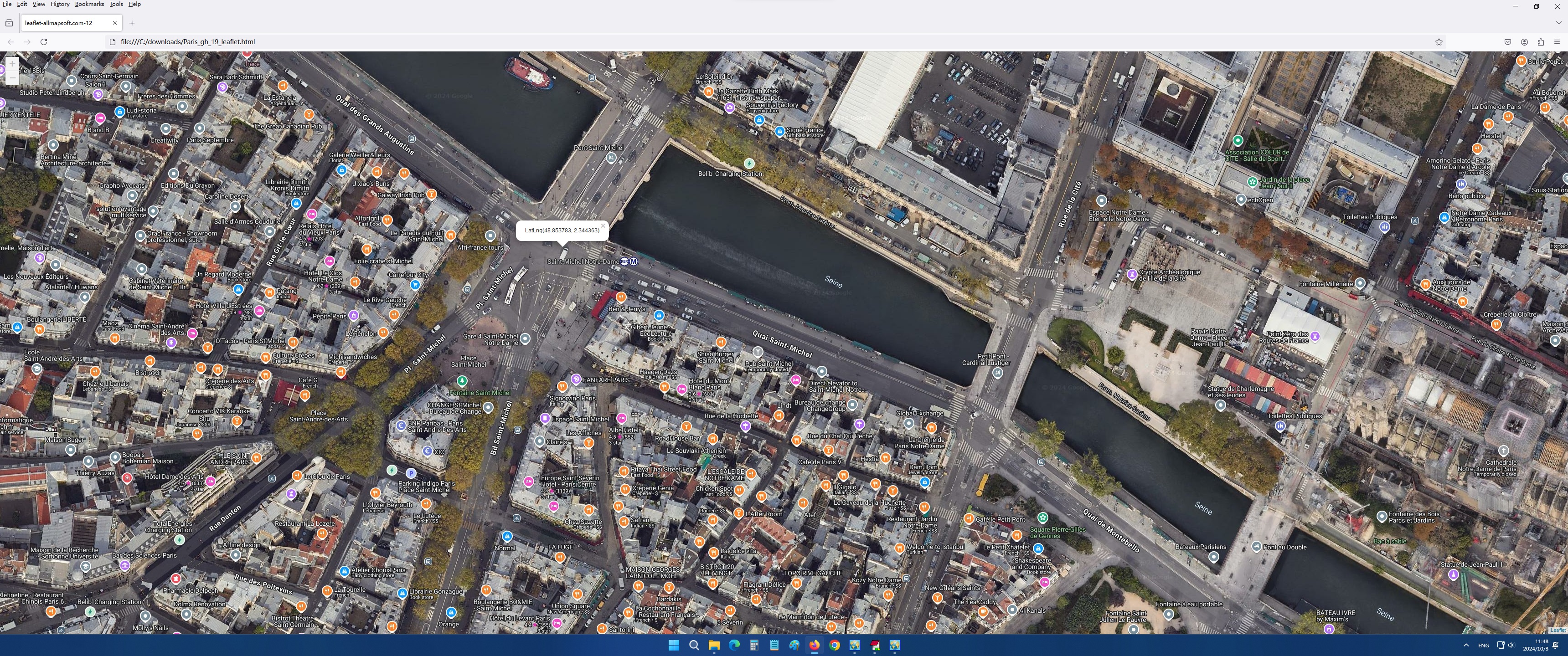
用浏览器查看地图

用浏览器查看地图

将下载的瓦片发布为网页地图,并在任意浏览器中打开——与通过 Map Viewer 得到的页面相同,无需打开程序。

查看原图

仅需 69 USD!

69 美元一次性付款 · 终身授权

先试用免费版:下载软件,将其指向上方列表中的任意地图来源,看看瓦片是如何下载到您磁盘上的,然后再做决定。

关于试用版: 这是共享软件,试用版最大缩放级别为 13,因此无法下载高分辨率图像。

支持邮箱: umd@allmapsoft.com

购买前有疑问? 阅读常见问题 或 查看更新历史。